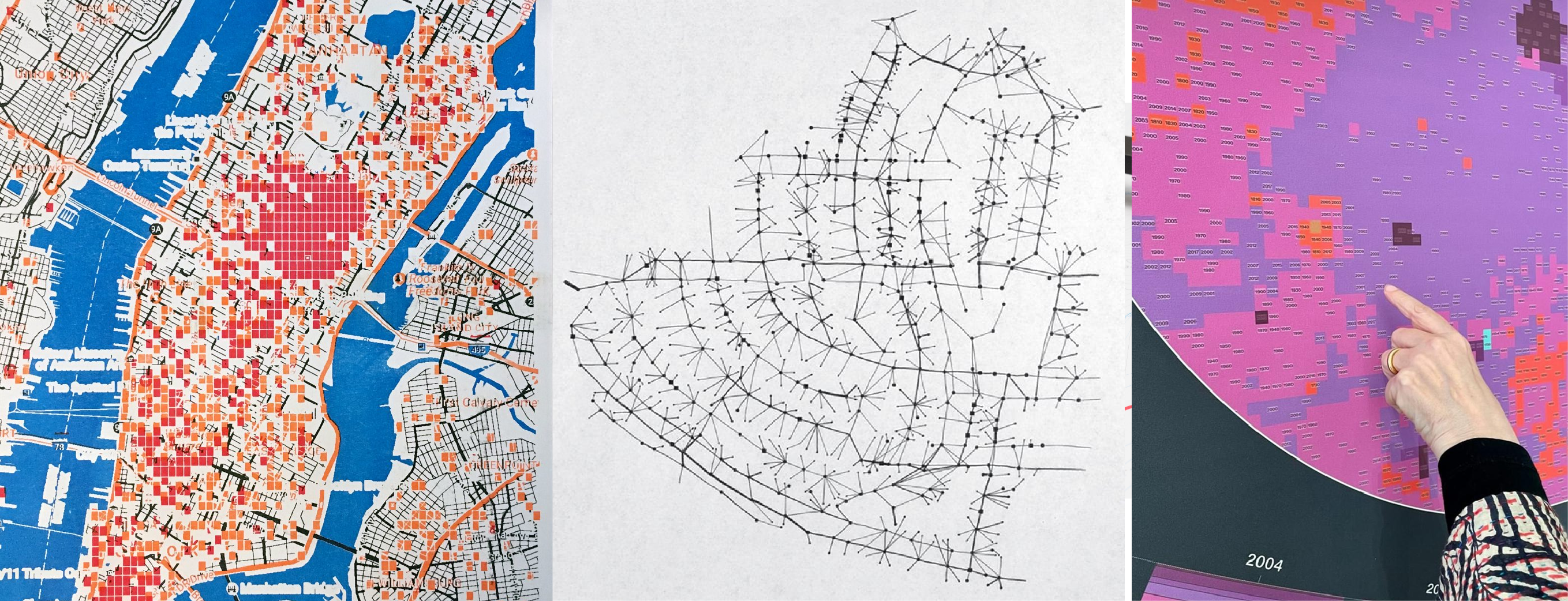
From left: Brian Clifton, Sam Lavigne, and Francis Tseng. "White Collar Crime Risk Zones." The New Inquiry, 2017.; Dennis Wood. 2011. "Everything Sings: Maps for a Narrative Atlas" via Places Journal; Laura Kurgan, Dan Miller, and Adam Vosburgh. "Two Sides of the Same Coin." Milan Triennale, 2025.
Syllabus
Spring 2026 Friday 9-11 3 credits 300 Buell South
Adam Vosburgh adam (dot) vosburgh (at) columbia.edu office hours by appointment, sign up at the link on the top of the page.
Description
This course provides an introduction to the critical use of geographic information systems (GIS) and the use of spatial methods for urban humanities research.
Maps and geographic analysis are key tools for interpreting the built environment and the social conditions it contains. GIS methods allow for the analysis of geographic features together with attributes (environmental, social, demographic, political) of those places. The thoughtful use of spatial data can reveal previously unseen patterns, changing the way we see and engage with our world. However, maps are never just representations; they are nearly always active agents in shaping the worlds they describe. With this in mind, students will be introduced to a range of approaches for creating and manipulating spatial data with a focus on the forms of authorship, design, subjectivity embedded in spatial data and its uses.
This course is divided into two halves:
- In the first, participants will develop basic fluency with open-source mapping software, QGIS, methods of data collection and creation, and approaches and concepts in critical spatial analysis and map design through hands-on exercises and weekly assignments.
- In the second, particpants will form groups and develop their own proposals with data and methodologies of their own selection. This work will culminate in a series of two "Show and Tells" at the end of the class, and a final public-facing website.
Course Overview
| Date | Week | Topic | Tutorial due | Assignment due |
|---|---|---|---|---|
| 1/23 | 1 | Introduction to Critical GIS + Spatial Data Types | ||
| 1/30 | 2 | Cartographic Projections | Tutorial 1 & 2 | Assignment 0 |
| 2/06 | 3 | Georeferencing and Digitizing Archives | Assignment 1 | |
| 2/13 | 4 | Using and Collecting Data | Tutorial 3 | Assignment 2 |
| 2/20 | 5 | Remote Sensing | Tutorial 4 OR Tutorial 5 | Assignment 3 |
| 2/27 | 6 | |||
| 3/06 | 7 | Narrative & Design, Proposal Workshop | Tutorial 6 OR Tutorial 7 | Assignment 4, Draft Proposal |
| 3/13 | 8 | Kinne Week | ||
| 3/20 | 9 | Spring Break | ||
| 3/27 | 10 | "Spatial Intelligence" | Tutorial 9 OR Tutorial 10 + 11 | Assignment 5 |
| 4/03 | 11 | Living in the Map | Tutorial 12 | |
| 4/10 | 12 | Show and Tell Day 1 | Group 1 Final Presentation | |
| 4/17 | 13 | Show and Tell Day 2 | Group 2 Final Presentation | |
| 5/06 | Website Due | Assignment 6 (for extra credit) |
Weekly Schedule, Readings, & Assignments
All course tutorials and assignments will be posted here on the course website.
All readings and previous lecture slides will be posted in the course drive (linked at the top of the page).
Assignments should be submitted on the course Canvas and the course Miro (linked at the top of the page.)
1/23 | Week 1 | Introduction to Critical GIS + Spatial Data Types
In class
Group map critiques. Examples to be distributed during class
1/30 | Week 2 | Cartographic Projections
Assignment 0 due – NYC Trees
Readings (available in course drive)
Corner, James. "The Agency of Mapping." 2014.
Couclelis, Helen. "People Manipulate Objects (but Cultivate Fields): Beyond the Raster-Vector Debate in GIS." 1992.
Cooper, Danika. "Drawing Deserts, Making Worlds." Essay. In Deserts Are Not Empty, edited by Samia Henni, 79–107. Columbia University, 2022.
Review projects/precedent examples page. Pick out two-three examples each week to review thoroughly on your own.
Optional: Rankin, William. "Introduction Territory and the Mapping Sciences" in After The Map: Cartography, Navigation, and the Transformation of Territory in the Twentieth Century. Chicago: University of Chicago Press. 2016. [available online via CLIO here]
2/06 | Week 3 | Georeferencing and Digitizing Archives
Assignment 1 due – Intentional Misuse
Readings (available in course drive)
Baics, Gergely, and Leah Meisterlin. "Zoning Before Zoning: Land Use and Density in Mid-Nineteenth-Century New York City." 2016.
Gergely Baics, Wright Kennedy, Rebecca Kobrin, Laura Kurgan, Leah Meisterlin, Dan Miller, Mae Ngai.Mapping Historical New York: A Digital Atlas. New York, NY: Columbia University. 2025. Go through a case study or two, and then explore the data on your own.
Parshina-Kottas, Yuliya, Anjali Singhvi, Audra D.S. Burch, Troy Griggs, Mika Gröndahl, Lingdong Huang, Tim Wallace, Jeremy White, and Josh Williams. "What the Tulsa Race Massacre Destroyed." New York Times, May 24, 2021. For further research, Tulsa data files are located here.
Optional: "The Cartography of W.E.B. Du Bois's Color Line" in W.E.B. Du Bois's Data Portraits: Visualizing Black America: The Color Line at the Turn of the Twentieth Century. Battle-Baptiste, Whitney, and Britt Rusert, eds. Princeton Architectural Press, 2018. [selections]
2/13 | Week 4 | Using and Collecting Data
Assignment 2 due – Selective Digitization
Readings (available in course drive)
Ferrari, Marco, Elisa Pasqual, Alessandro Busi, Aaron Gillett. A Moving Border: Alpine Cartographies of Climate Change [Selections]. 2019
Wood, Denis. "Everything Sings: Maps for a Narrative Atlas." In Places Journal. 2011.
Optional: Williams, Sarah, Jacqueline Klopp, Daniel Orwa, Peter Waiganjo, and Adam White. "Digital Matatus: Using Mobile Technology to Visualize Informality." 2015.
2/20 | Week 5 | Remote Sensing
Assignment 3 due – Mapping Observations
Deadline to make group selections
Readings (available in course drive)
Kurgan, Laura. "Mapping Considered as a Problem of Theory and Practice." 2013.
Please also review from week 2: Couclelis, Helen. "People Manipulate Objects (but Cultivate Fields): Beyond the Raster-Vector Debate in GIS." 1992
2/27 | Week 6 | Narrative & Design Class cancelled - I am sick :(
Assignment 4 due – Mapping Remotely
#### Readings
3/06 | Week 7 | Proposal Workshop
Assignment 4 due – Mapping Remotely
Readings
Please read these map-based articles from the New York Times:
-
- across these articles and when watching In Plain Sight try to focus on identifying the core narrative, and then on discerning how the narrative is being conveyed via the maps and other media used
- there is a longer list of New York Times map-based articles included at the end of the precedents page, please feel free to read several of these in addition to the two listed above (if you choose to read an NYT map article that is not already on cited on the precedents page list, please include a link to the article in your discussion question post on Canvas).
-
Columbia University Libraries provides access to NYTimes.com for all students. Please see instructions here to set up an account
Proposal Due
Sign-up for a workshop time on the day of class to go over your proposal.
3/13 | Week 8 | Kinne Week
We may or may not have class depending on people's travel plans.
3/20 | Week 9 | Spring Break - No Class
3/27 | Week 10 | "Spatial Intelligence"
Assignment 5 due
Readings (available in course drive or linked here)
Crawford, Kate. Atlas of AI. Yale University Press, 2021. pp. 1-21, 181-209.
Fatima, Tazbia. "We Asked an AI to Map Our Stories Across NYC." The City, 2024.
Please watch: Laura Kurgan, Adeline Chum, Michael Krisch, Adam Vosburgh, Jia Zhang. "The Curse of Dimensionality." Venice Architecture Biennale, 2025. Video Link Here.
Supplemental Readings by Topic:
General AI Hao, Karen. Empire of AI: Dreams and Nightmares in Sam Altman's OpenAI. Penguin Press, 2025. pp. 175–223.
Targeting Machines
- +972 Magazine. "'Lavender': The AI machine directing Israel's bombing spree in Gaza." April 2024.
- Khlaaf, Heidy, Sarah Myers West, and Meredith Whittaker. "Mind the Gap: Foundation Models and the Covert Proliferation of Military Intelligence, Surveillance, and Targeting." arXiv, October 2024.
- The Independent. "Old intelligence and AI? Behind the deadly attack on an Iranian girls’ school that left 175 dead." March 2026.
- EFF. "The Anthropic-DOD Conflict: Privacy Protections Shouldn't Depend On the Decisions of a Few Powerful People." March 2026.
Location Intelligence
- The Markup. "There's a Multibillion-Dollar Market for Your Phone's Location Data." 2021.
- jawg.io. "What does Overture Maps mean for OpenStreetMap and the future of open source mapping?" 2023.
- Google DeepMind. "AlphaEarth Foundations helps map our planet in unprecedented detail." 2025.
Text as Spatial Data
- Fatima, Tazbia. "We Asked an AI to Map Our Stories Across NYC." The City, 2024.
- Living with Machines. Machines Reading Maps. Alan Turing Institute + British Library.
4/03 | Week 11 | Living in the Map
Readings
House, Brian. "Stalking the Smart City." 2019
Kurgan, Laura, Dan Miller, and Adam Vosburgh. "Two Sides of the Same Coin." Milan Triennale, 2025. Read the text on that site, and check out the visualization at twosides.earth
Supplementary Readings by Topic:
Two Sides of the Same Coin
- E.C. Ellis, N. Gauthier, K. Klein Goldewijk, R. Bliege Bird, N. Boivin, S. Díaz, D.Q. Fuller, J.L. Gill, J.O. Kaplan, N. Kingston, H. Locke, C.N.H. McMichael, D. Ranco, T.C. Rick, M.R. Shaw, L. Stephens, J. Svenning, & J.E.M. Watson, People have shaped most of terrestrial nature for at least 12,000 years, Proc. Natl. Acad. Sci. U.S.A. 118 (17) e2023483118, https://doi.org/10.1073/pnas.2023483118 (2021).
- Link to HYDE Data
- Pasolli E, Asnicar F, Manara S... Extensive Unexplored Human Microbiome Diversity Revealed by Over 150,000 Genomes from Metagenomes Spanning Age, Geography, and Lifestyle. Cell, 2019; 176, 649-662.e20
Fire Insurance
- Tambunan, Aatish. "Insurers Are Spying on Your Home From the Sky." Wall Street Journal, April 6, 2024.
- Flavelle, Christopher, Mira Rojanasakul, Desiree Rios. "Home Insurance Rates in America Are Wildly Distorted. Here’s Why." New York Times, July 8, 2024.
- Liu, Coco, and Saijel Kishan. "AI-Powered Home Insurance Startup Expands in Risky Markets." Los Angeles Times (Bloomberg), October 17, 2025.
- Darmiento, Laurence, and Summer Lin. "California Homeowners Are Getting Cancelled by Their Insurers, and the Reasons Are Dubious." Los Angeles Times, January 12, 2025.
Smart Cities
- Architectural Record. "The End of Sidewalk Labs." 2020.
- Greenfield, Adam. "Against the Smart City." Urban Omnibus, 2013.
- Mattern, Shannon. "Interfacing Urban Intelligence." Places Journal, 2014.
Trees
4/10 | Week 12 | Show and Tell Day 1
Group 1 Presentations
4/17 | Week 13 | Show and Tell Day 2
Group 2 Presentations
5/06 | Website Due
Assignment 6 due (for extra credit)
Class Requirements and Grading
Grading for the class is as follows:
There are a total of 21 possible points. Attendance for each session, assignments and in class contribution each count for one point. The final project is worth four points. 19 points and above is a HP, 15 points and above is a P, 12 points and above is a LP, and anything below that is a F.
Attendance (11 points) Attendance at all class sessions is required. Per GSAPP attendance policy, three unexcused absences is an automatic Unofficial Withdrawal (UW).
In-class participation (1 point) You are expected to give engaged and generous participation in class discussions and in critique workshops with your peers.
Assignments (5 points, 1 point each) Weekly map assignments will allow you to apply the skills acquired via tutorials and begin to experiment with creative applications of spatial methods. Assignments are graded on completion and are intended to be limited in scope; experimental; and geared towards learning and creative engagement rather than demonstrating advanced skills. Assignment descriptions and associated assessment rubrics can be found on the assignments tab of the course site.
Final Project + Presentation (4 points) The final project is worth four total points. Two points will be awarded based on the show and tell presentation, and two points will be awarded for the final submission on the course website.
Extra Credit (1 point each) Extra credit will be given for the completion of assignment 5, and additional extra credit can be assigned by the instructor in the even that a student has a LP or F.
Learning Objectives
After completing the course participants will:
- Develop robust familiarity with QGIS and its functions
- Gain fluency with foundational GIS concepts (including how the GIS data model abstracts geographic phenomena)
- Understand GIS spatial data types and the kinds of analysis that are possible with each
- Create new spatial datasets from field observation and participatory sensing
- Create new spatial datasets from archival sources
- Access and use multispectral satellite imagery
- Acquire fluency with visual design concepts central to cartographic representations
AI Policy
Students are welcome to use AI tools in the class, except for the purpose of:
- Developing maps or images for the purpose of turning them in as a student's own work.
- Producing original writing that the student turns in as their own work.
- Prompting a LLM to produce data for them. This will ALWAYS result in fabricated data.
- Asking a LLM to analyze data for you. This is only permissible if complimented with a robust human analysis.
Uses of AI in these ways is counter to the critical objectives in this class. Work that uses AI in these ways, and in other ways that the instructor determines are counter to the objectives of the class, will not be awarded points.
Software
Geographic Information Systems is not a software. As such this course will not seek to provide students with proficiency in a particular software platform. Tutorial resources will be primarily provided for QGIS LTR. This is an open source software program for geographic analysis that runs on Windows, Mac, and Linux operating systems. All students will be expected to download and install QGIS LTR. Documentation for QGIS is available here, and a training manual with good basic tutorials is available here and an introduction to GIS methods using QGIS is available here. Information regarding other GIS softwares will be provided in course resources. Knowledge of design and layout programs (Adobe Illustrator, and InDesign) may be useful to you but is not required.
Academic Integrity
The intellectual venture in which we are all engaged requires of faculty and students alike the highest level of personal and academic integrity. As members of an academic community, each one of us bears the responsibility to participate in scholarly discourse and research in a manner characterized by intellectual honesty and scholarly integrity.
Scholarship, by its very nature, is an iterative process, with ideas and insights building one upon the other. Collaborative scholarship requires the study of other scholars' work, the free discussion of such work, and the explicit acknowledgement of those ideas in any work that inform our own. This exchange of ideas relies upon a mutual trust that sources, opinions, facts, and insights will be properly noted and carefully credited.
In practical terms, this means that, as students, you must be responsible for the full citations of others' ideas in all of your research papers and projects; you must be scrupulously honest when taking your examinations; you must always submit your own work and not that of another student, scholar, or internet agent.
Any breach of this intellectual responsibility is a breach of faith with the rest of our academic community. It undermines our shared intellectual culture, and it cannot be tolerated. Students failing to meet these responsibilities should anticipate being asked to leave Columbia.
For more information on academic integrity at Columbia, students may refer to the Columbia University Undergraduate Guide to Academic Integrity as well as the GSAPP Honor System and Plagiarism Policy.
Community & Accessibility
This is a discussion and collaborative-critique based course. All students and the instructor must be respectful of others in the classroom. If you ever feel that the classroom environment is discouraging your participation or is problematic in anyway please contact me.
GSAPP is committed to full inclusion of all students. Students needing any form of accommodation due to a disability should check in with Disability Services (DS) and speak with me at the beginning of the semester to provide the accommodations letter from DS. Alternatively you may ask your advisor to consult with me regarding your accommodations.
Email Policy
Students should not rely on or expect an immediate response to questions sent via email to the instructor. Please begin assignments with enough time to attend office hours or ask a question several days before the assignment is due.
Learning how to troubleshoot technical issues and locate relevant resources is crucial in your long-term success with GIS methods. With this in mind emails with technical questions must at a minimum contain the following:
- a clear description of what you are trying to do, and what the problem is
- a summary of the steps you have already taken to address the issue
- screenshots (where applicable) that help to explain the problem
- a link to at least one website you consulted for assistance with the issue before writing the email.The QGIS docs is a good starting place as is GIS Stack Exchange.
Bibliography
Baics, Gergely, and Leah Meisterlin. "Zoning Before Zoning: Land Use and Density in Mid-Nineteenth-Century New York City." Annals of the American Association of Geographers 106, no. 5 (September 2, 2016): 1152–75.
Battle-Baptiste, Whitney, and Britt Rusert, eds. W.E.B. Du Bois's Data Portraits: Visualizing Black America: The Color Line at the Turn of the Twentieth Century. First edition. [Amherst, Massachusetts] : Hudson, NY: The W.E.B. Du Bois Center at the University of Massachusetts Amherst ; Princeton Architectural Press, 2018.
Corner, James. "The Agency of Mapping." In Landscape Imagination: Collected Essays of James Corner 1990-2010. New York, UNITED STATES: Princeton Architectural Press, 2014.
Cooper, Danika. "Drawing Deserts, Making Worlds." Essay. In Deserts Are Not Empty, edited by Samia Henni, 79–107. Columbia University, 2022.
Couclelis, Helen. "People Manipulate Objects (but Cultivate Fields): Beyond the Raster-Vector Debate in GIS." In Theories and Methods of Spatio-Temporal Reasoning in Geographic Space, edited by A. U. Frank, I. Campari, and U. Formentini, 639:65–77. Lecture Notes in Computer Science. Berlin, Heidelberg: Springer Berlin Heidelberg, 1992.
Desimini, Jill, and Charles Waldheim. "Introduction: Projecting the Landscape Imaginary." In Cartographic Grounds : Projecting the Landscape Imaginary. New York: Princeton Architectural Press, 2016.
Ferrari, Marco, Elisa Pasqual, and Andrea Bagnato. A Moving Border: Alpine Cartographies of Climate Change. New York, NY: Columbia Books on Architecture and the City, 2019.
House, Brian. "Stalking the Smart City." Urban Omnibus 2019
Kurgan, Laura. "Mapping Considered as a Problem of Theory and Practice." In Close up at a Distance : Mapping, Technology, and Politics, 9–18. Brooklyn, NY: Zone Books, 2013.
Mörtenböck, Peter, and Helge Mooshammer, eds. Informal Market Worlds: The Architecture of Economic Pressure. Rotterdam: NAI010 Publishers, 2015.
Rankin, William. "Introduction Territory and the Mapping Sciences" in After The Map: Cartography, Navigation, and the Transformation of Territory in the Twentieth Century. Chicago: University of Chicago Press. 2016.
Williams, Sarah, Jacqueline Klopp, Daniel Orwa, Peter Waiganjo, and Adam White. "Digital Matatus: Using Mobile Technology to Visualize Informality." ACSA Annual Meeting Proceedings, The Expanding Periphery and the Migrating Center, 2015, 9.
Wood, Dennis. "Everything Sings: Maps for a Narrative Atlas." In Places Journal. 2011.
Woods, Clyde Adrian., and Katherine. McKittrick. "No One Knows the Mysteries at the Bottom of the Ocean." In Black Geographies and the Politics of Place. Toronto, Ont. : Cambridge, Mass.: Between the Lines ; South End Press, 2007.
Parshina-Kottas, Yuliya, Anjali Singhvi, Audra D.S. Burch, Troy Griggs, Mika Gröndahl, Lingdong Huang, Tim Wallace, Jeremy White, and Josh Williams. "What the Tulsa Race Massacre Destroyed." New York Times, May 24, 2021. https://www.nytimes.com/interactive/2021/05/24/us/tulsa-race-massacre.html.
Brian Clifton, Sam Lavigne, and Francis Tseng. "White Collar Crime Risk Zones." The New Inquiry, 2017. https://whitecollar.thenewinquiry.com/.
Laura Kurgan, Dan Miller, and Adam Vosburgh. "Two Sides of the Same Coin." Milan Triennale, 2015. https://c4sr.columbia.edu/projects/two-sides-same-coin.